the goan I network
MARGAO
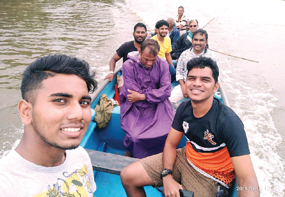
Traditional fishermen inhabiting the banks of river Sal in the riverine villages of Velim, Ambelim and Assolna are on a different mission. Equipped with a motorised canoe, the fishermen along with students and experts moved around in the river, taking them right from Cutbona in Velim to Deussua in Chinchinim. And, the objective behind the boat ride is not for fishing as may appear, but to map the fishing spots in the river as well as sluice gates before they are all incorporated in the Coastal Zone Management Plan (CZMP).
The river Sal is the home for rich species of shell fish, including kalva, tisreos, shinaneos and kube, besides river fish such as the much-sought after shevtte and mordoshe. If the Ambelim-Bandar area is the home for kalvas, the area around Zug Mobor is famous for shenaneos. While the river course around the Betul jetty area is known for much-sought after tisreos and kubes, stakes erections along the river course from Velim to the Deussua-Orlim bridge point helps the traditional fishermen to net river fish, making Sal the biggest river fishing belt.
Sadly, the fishing points in the river Sal and the fishing areas in these villages found no mention in the draft CZMP prepared by the Chennai-based NCSCM agency.
Former Ambelim sarpanch Cruz Silva told The Goan that the fishermen roped in students from the Department of Geology, Chowgule College, Margao to help them map the fishing areas in the river Sal. “The draft CZMP was silent on the fishing activities despite the fact that the river Sal has been the home for rich species of shell fish and river fish, over the years. Hence, the fishermen have decided to carry out the exercise of mapping the coastal features with the help of the college students,” he added.
He pointed out that the team will map the coastal features in the CZMP, including sluice gates (mush), fishermen’s huts and communities, community canoe ramp, location of aryo (traditional fishing), fish breeding grounds of tisreos (clamps), zob (muscles), kalva (bar), etc, sanbards, aqua culture (manshios). “The exercise will also get the community celebration sites (traditions of Sao Pedro and Sao Paul, bat habitat, trawler dock, etc on the draft CZMP. We intend to prepare a draft plan of the fishing areas in the river Sal, right from Velim to Deussua at the Orlim bridge,” he said.
Cruz pointed out that the fishermen had to avail the services of the students and a teacher to carry out the mapping of fishing areas in river Sal as the government is yet to place at the disposal of the fishermen, experts to conduct the mapping exercise.